How do I change the look of the map or how parcels are labeled?
Troubleshooting & Help
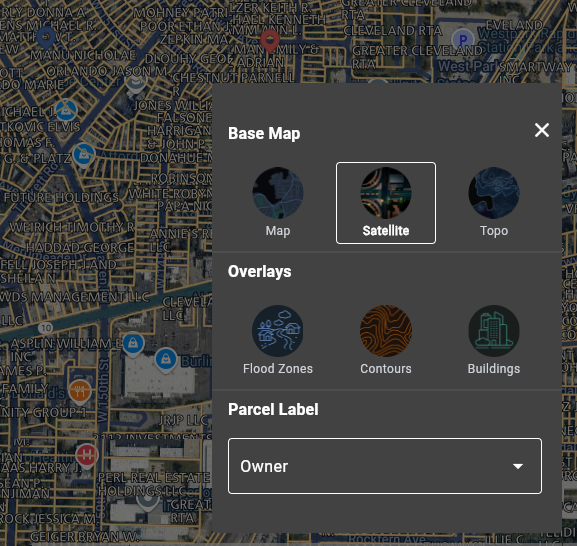
LandGlide® offers three base maps:
- Street Map
- Satellite View
- Topo (USGS topographic view)
To change the base map, click on the Map icon on the bottom right of the map. It is the top button of the three on the map screen. Then tap the Layers icon and tap on the Base Map view you would like to see, and that will appear.
Along with the Base Map, you can choose an Overlay to be shown on the map. The available overlays are:
- Flood Zones
- Contours
- Buildings
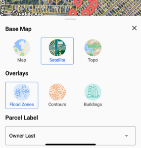
From this same menu, you can change how the parcels are labeled. Once again, tap the Map icon to start. Tap on the Layers icon, then tap on Labels. From here, you can choose one of the six options for labeling the parcels.
- Owner
- Owner Last (Last name only)
- Street Address
- Street Address Number
- Parcel ID
- None
For web users: Click the Map icon on the right of the map
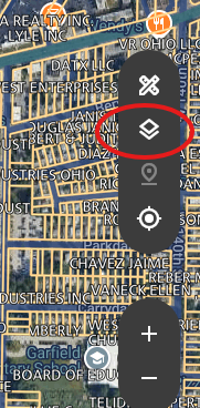
This will bring up the Map View options. Click the options you prefer to change how the map looks.